
|
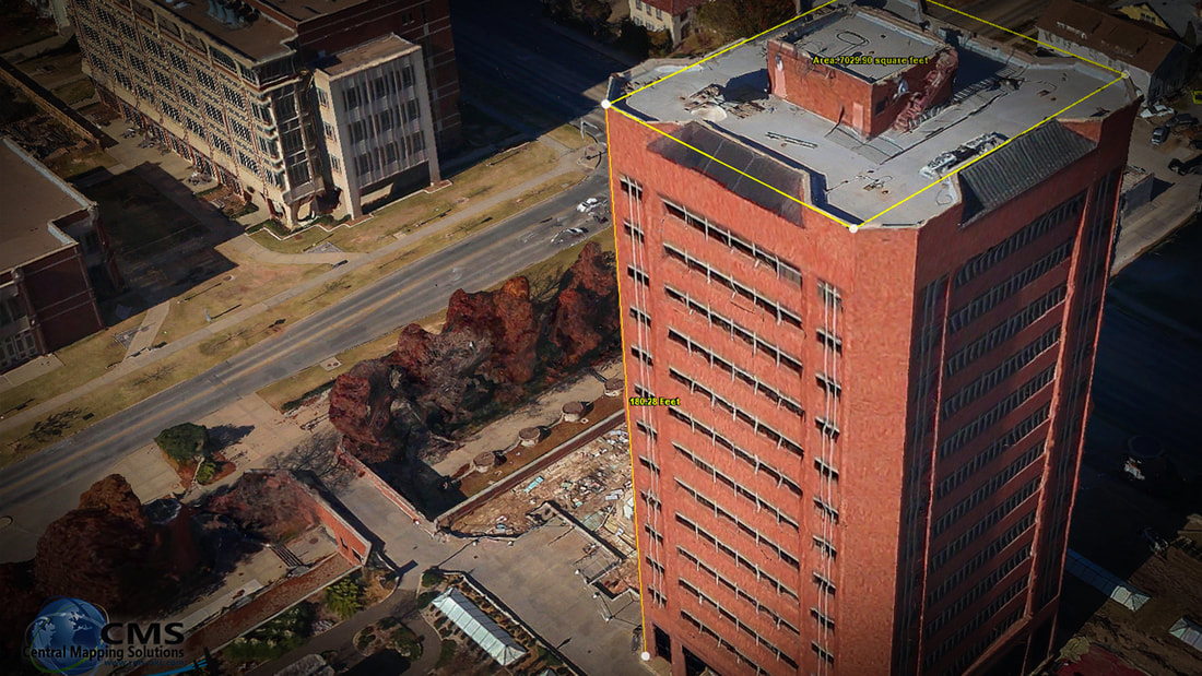
Oblique Photography
Progress Reports : Real Estate : Legal Disputes |
|
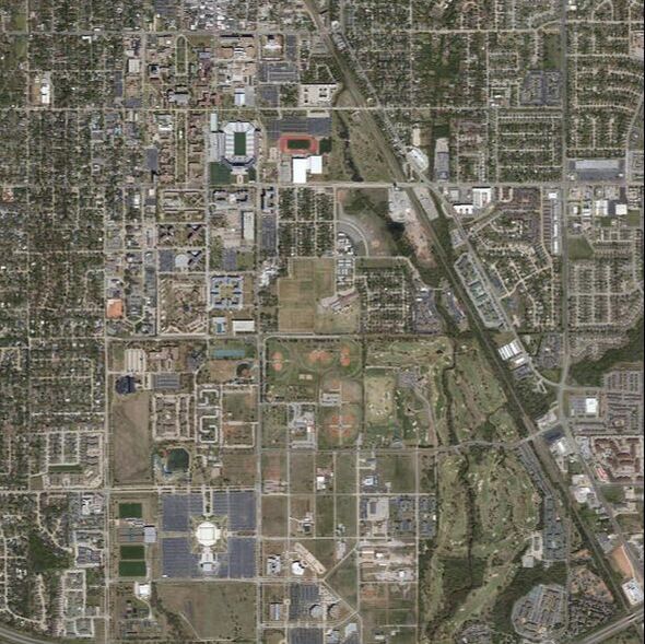
3D Smart City
Aerial Photography for Smart City Applications 3D technology is playing an increasingly important role in the development of smart cities. A realistic 3D city model combines base maps; imagery; elevation information; and objects, such as buildings and bridges. The 3D City Model can also go below ground to include subsurface structures, such as basements, parking structures, subway systems, and utility infrastructure. Using Skyline’s TerraExplorer or ESRI’s ArcGIS template, features such as street furniture, vegetation, cars, and people seem to bring virtual cities to life. |
|
Digital Orthophoto & Mosaics
An orthophoto is an aerial photograph that has been geometrically corrected or 'ortho-rectified' such that the scale of the photograph is uniform and utilised in the same manner as a map. An ortho-photograph can be used to measure true distances of features within the photograph. Planimetric corrections have been applied to remove lens distortions and optics, camera angle, and differences in elevation (topographic relief) through a process of measuring ground control points to 'tie' the photo to the ground, in a drawing-pin like manner. An orthophoto is an accurate representation of the Earth' s surface. Orthophotos have the benefits of high detail, timely coverage combined with the benefits of a map including uniform scale and true geometry. |
|
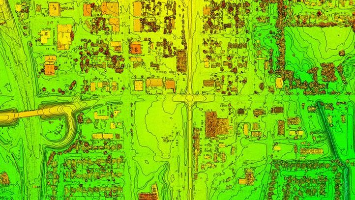
TOPOGRAPHY MAPPING
Contouring - DSM - DTM - DEM A topographic survey is made to establish the configuration of the ground and the location of natural and man-made objects. Topographic Maps illustrate elevation with the use of contour lines and spot elevations. Planimetric Maps show features such as roads, buildings, water, fences, vegetation, bridges, railroads. |
|
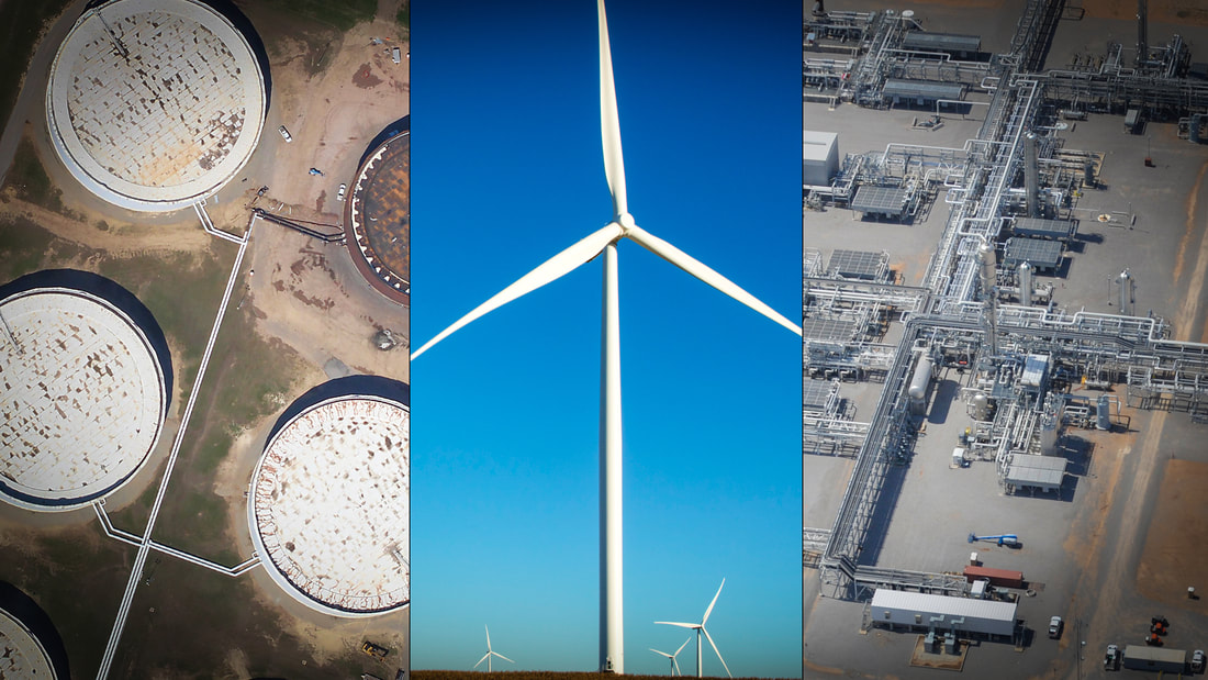
ENERGY
Aerial Photography of Oil & Gas - Wind Energy - Refinery Sites |
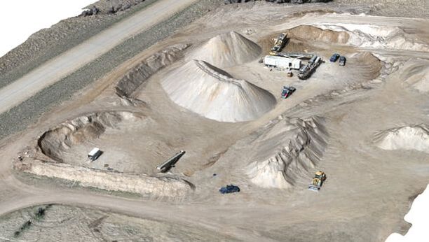
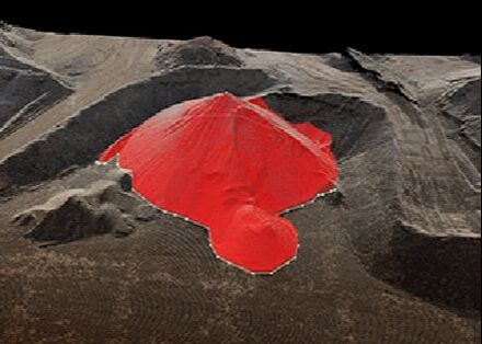
VOLUMETRIC CALCULATIONS
With Aerial Photography of Stockpiles - Quarries - Mining
With Aerial Photography of Stockpiles - Quarries - Mining
|
|
- Accurate - Equal to or better than traditional aerial survey methods
- Frequency - Measure Daily, Monthly, Quarterly and/or Annually
- Fast - Reports provided within 24 – 48 hours of inspection
- Quick Data Collection - Save significant time and labor – collect an entire site’s data often in minutes, not several hours or days
- Safe - Eliminates the need to climb on stockpiles – significantly improves employee safety, MSHA compliance and reduces site
insurance costs - Reduce Capital Expenditures - Eliminate the need to purchase expensive survey measuring equipment
- Improve Decision Making and Planning - Having confidence in the accuracy of your volumetric data allows you to plan smart-er and make better decisions with fewer end of year accounting adjustments
- Streamline Inventory Material Audits - Readily available, documented, independent third party inspection with audit history of all material inventories
ADDITIONAL SERVICES INCLUDE


Remote Sensing
|

Digital Mapping
|

Custom Data Processing
|